
When Earth Becomes a Work of Art
Some natural wonders are impressive from the ground but truly understandable only from the sky. Elevation reveals hidden circles, branching waterways, color contrasts, and immense geological patterns that disappear at eye level. From coral mosaics to desert bull’s-eyes, these destinations prove that nature sometimes designs for a bird’s-eye view.
The Richat Structure, Mauritania
From the ground, the Richat Structure looks like a rugged collection of ridges in the Sahara. From above, it becomes a spectacular bull’s-eye roughly 25 miles wide, earning its nickname, the Eye of the Sahara.
Once suspected to be an impact crater, it is actually a deeply eroded geological dome. Layers of rock wore away at different rates, producing concentric rings that appear surprisingly precise. NASA’s closer look at the Richat Structure shows why the formation has long fascinated astronauts.
The Great Blue Hole, Belize
Divers entering Belize’s Great Blue Hole encounter a vast underwater cavern, but they cannot see the feature’s most famous quality: its near-perfect circular shape.
An aerial view reveals a dark blue disk surrounded by the turquoise shallows of Lighthouse Reef. Measuring roughly 1,000 feet across, the sinkhole formed as part of a limestone cave system when sea levels were lower. Rising water eventually submerged it, creating one of the ocean’s most recognizable natural patterns.
The Blue Hole is also featured among Tour Trivia’s hidden natural wonders worth exploring.
The Great Barrier Reef, Australia
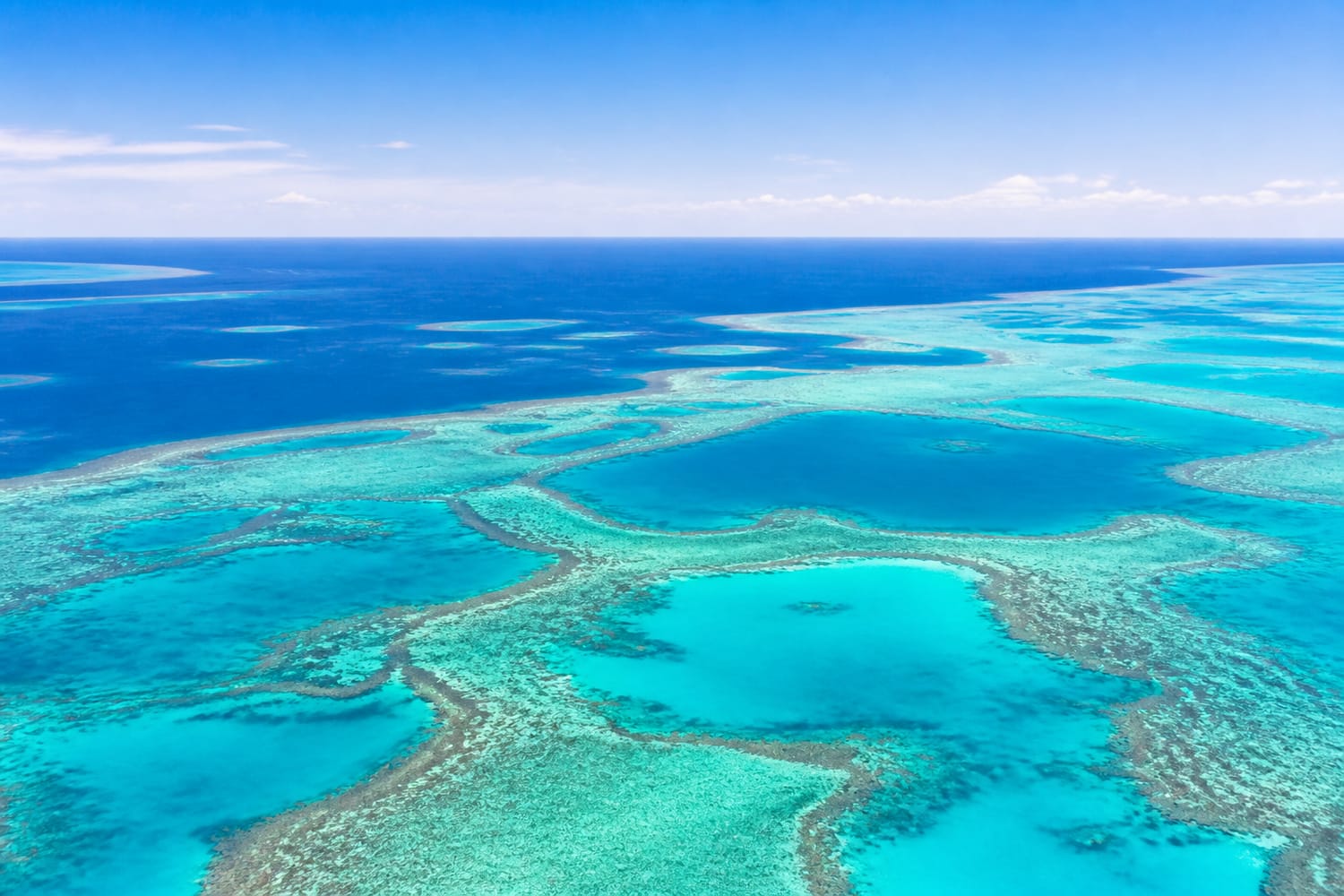
Underwater, the Great Barrier Reef is a busy world of coral, fish, turtles, and shifting light. From the air, those individual encounters become part of an enormous interconnected system.
The reef appears as a sprawling mosaic of turquoise lagoons, pale sandbars, coral cays, and dark ocean channels. It contains thousands of individual reefs extending along Australia’s northeastern coast. This scale explains why the Great Barrier Reef’s UNESCO profile celebrates its aerial panorama as well as its extraordinary marine biodiversity.
The Okavango Delta, Botswana
At ground level, Botswana’s Okavango Delta can feel like a confusing maze of reeds, lagoons, islands, and wildlife trails. From above, its logic becomes visible.
Water spreads into the Kalahari Basin in branching blue-green veins, forming an immense inland delta that does not empty into an ocean. Seasonal floods continually reshape its channels, grasslands, and islands. The contrast between thriving wetlands and the surrounding dry landscape makes an aerial approach one of the most memorable parts of visiting this remarkable ecosystem.
Salar de Uyuni, Bolivia
Bolivia’s Salar de Uyuni feels endless from the ground, where its flat white crust stretches toward a distant horizon. A higher viewpoint reveals something even stranger: an enormous geometric blank space among the brown ridges of the Andes.
Covering more than 10,000 square kilometers, it is the world’s largest salt flat. During wet periods, a shallow layer of water turns parts of the surface into a vast mirror, making the horizon almost disappear.
It is one of several landscapes in Tour Trivia’s guide to surreal places that seem almost imaginary.
Grand Prismatic Spring, United States
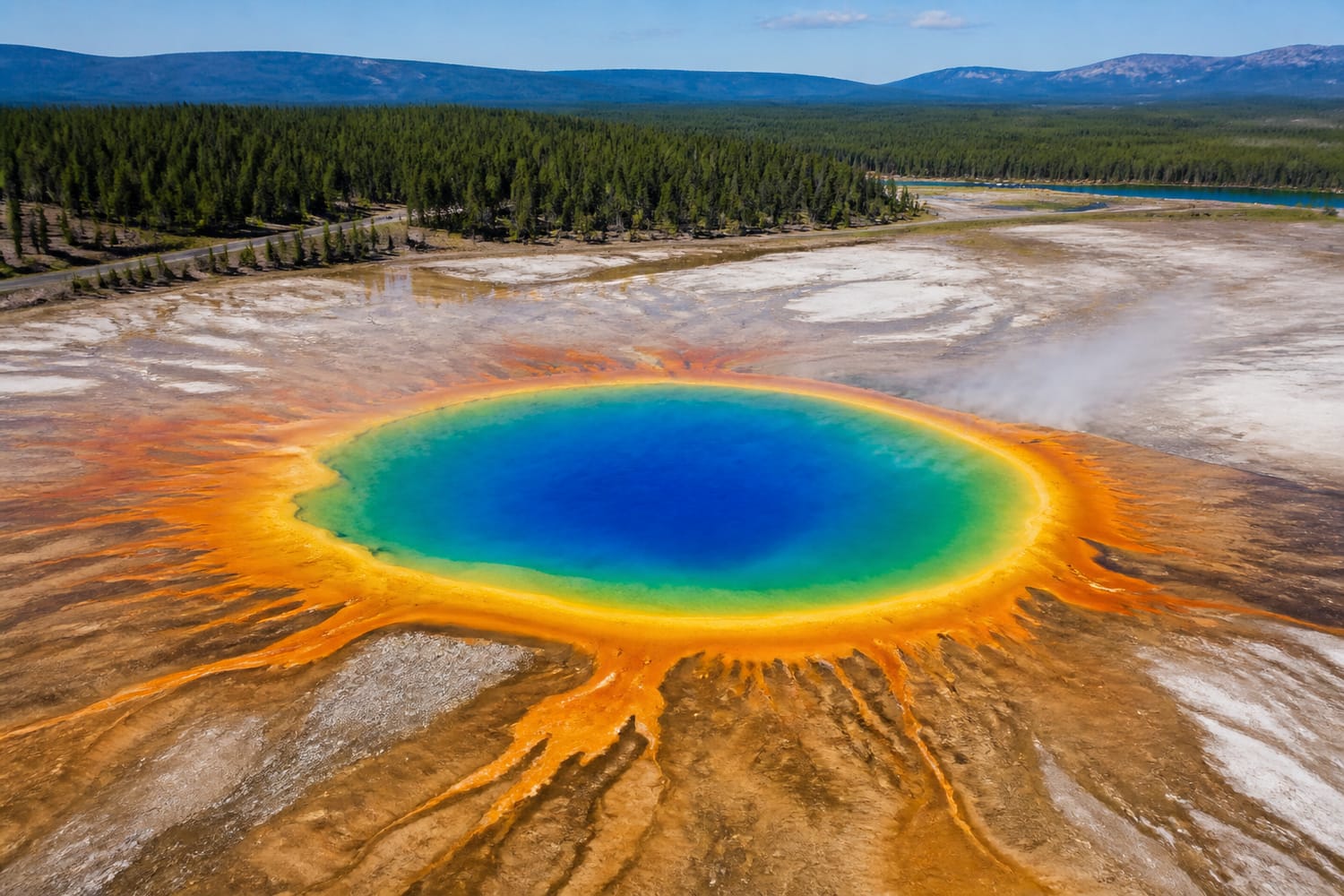
Yellowstone’s Grand Prismatic Spring is colorful from its boardwalk, but steam and the low viewing angle can obscure its complete design. Seen from above, the hot spring resembles a giant eye painted in electric blue, yellow, orange, and rust.
The spring’s blue center is surrounded by colorful microbial communities adapted to different temperatures. Its remarkably orderly bands make more sense from an elevated overlook or aerial perspective. The National Park Service offers a helpful guide to Grand Prismatic Spring and the science behind its colors.
Lençóis Maranhenses, Brazil
Lençóis Maranhenses may resemble a traditional desert at first, but the landscape receives enough rain to create seasonal freshwater lagoons between its immense dunes.
From above, brilliant blue and green pools fill the curves between white ridges, producing a pattern reminiscent of rippling fabric or marbled paper. Winds continually move and reshape the dunes, while the lagoons change size, color, and position with the seasons. The complete scale and rhythm of this evolving landscape are nearly impossible to appreciate from ground level alone.
Iceland’s Braided Glacial Rivers
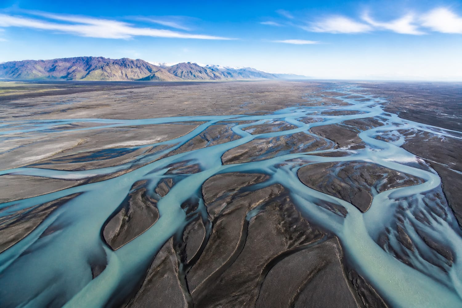
Iceland’s glacial rivers can look gray, muddy, and intimidating from their banks. Viewed from the air, however, they become delicate works of abstract art.
Meltwater splits into countless channels as it flows across broad plains of dark volcanic sediment. Those channels divide, reconnect, and curl around temporary islands, creating patterns that resemble tree roots, lightning bolts, or veins. Suspended glacial sediment can also give the water milky blue tones that stand out dramatically against black sand.
Ngorongoro Crater, Tanzania
Standing on the floor of Ngorongoro Crater makes it easy to focus on its grasslands, lakes, and famous wildlife. Seeing it from above reveals the larger geological story.
The crater is the world’s largest intact, unfilled volcanic caldera. Its steep, continuous walls encircle a vast interior ecosystem, forming what looks like a self-contained natural arena. From the rim or the air, the bowl shape becomes unmistakable, and herds moving across the crater floor appear as tiny marks within a colossal volcanic footprint.
Lake Hillier, Australia
Lake Hillier sits close to the coast of Western Australia’s Middle Island. Its celebrated pink color is striking, but it is the aerial contrast that made the lake internationally famous.
From above, the lake’s rosy water appears beside the deep blue Southern Ocean, separated by a narrow band of green vegetation and pale sand. Its color intensity can vary as environmental conditions change, yet the unusual layout remains compelling. Few landscapes demonstrate color contrast as neatly, making it a natural companion to Tour Trivia’s collection of the most colorful places on Earth.
A Planet of Hidden Patterns
Aerial views do more than make landscapes look beautiful. They reveal how water moves, how reefs connect, how rock layers erode, and how ecosystems fit into their surroundings.
That change in perspective can transform an apparently ordinary river, lake, or ridge into something astonishing. As Tour Trivia’s exploration of landmarks visible from space demonstrates, sometimes the best way to understand Earth is simply to step far enough back.