
A River’s Curves Are a Work in Progress
Rivers wind because flowing water erodes the outside of a bend and deposits sediment on the inside. That small difference gradually makes the bend larger. Given room to move across a floodplain, a river can develop sweeping loops called meanders—and sometimes cut through a loop to leave an oxbow lake behind.
From a hillside, a winding river can look like a line drawn in one confident stroke. Up close, it is less like a drawing and more like a construction site: one bank is being worn away while another is being built. The curves we admire are snapshots of a channel that may still be changing.
How Does a Bend Begin?
A river does not need a dramatic obstacle to turn. A slight irregularity in its bank or bed can nudge the current off a straight course. Once a bend develops, the flow around it becomes uneven, allowing erosion and deposition to reinforce the curve. Scientists have found that the processes behind meandering can begin even in relatively straight channels.
The landscape matters, too. A river crossing a broad, relatively flat valley has more opportunity to shift sideways than one confined by steep valley walls. Its eventual shape depends on several interacting conditions, including the slope, the amount of water flowing, the sediment it carries, and how readily its banks erode. There is no single rule that makes every river follow the same pattern.
What Happens on Each Side of a Curve?
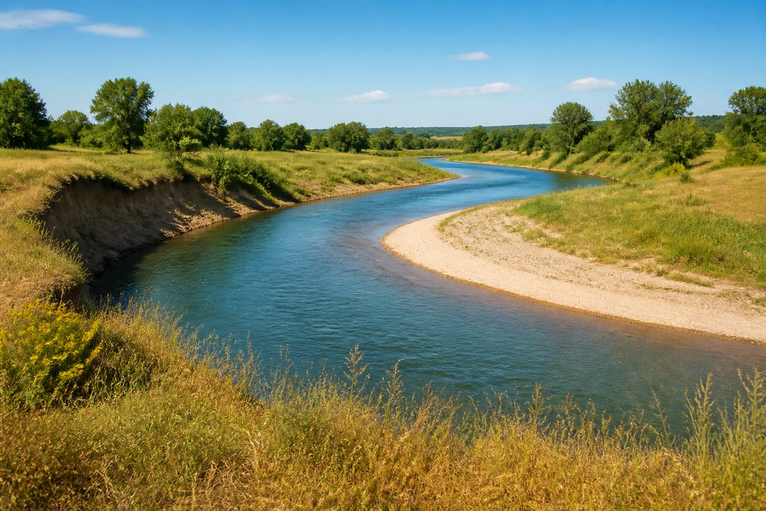
Imagine looking downstream at a river bend. Along the outside, faster flow presses against the bank and wears material away. This eroding edge is called a cut bank. Along the inside, slower flow allows some of the river’s sediment to settle, building a gently sloping point bar. Sandbars and small river beaches often mark that quieter side. The National Park Service’s guide to meandering streams shows how these paired processes reshape a channel.
The sand on an inside bend has not necessarily come from the bank directly opposite it. Rivers carry material downstream, sorting, moving, and depositing it as conditions change. What matters for the bend’s growth is the overall pattern: erosion removes ground from its outer edge while deposition adds ground to its inner edge. Over time, that combination can shift the channel across its valley floor.
There is also more going on beneath the surface than a simple fast-side, slow-side diagram suggests. Water turning around a bend develops a secondary, circulating motion that helps move sediment through the channel. Still, the cut bank and point bar are the easiest clues to spot from shore—and they tell much of the story.
Why Do Meanders Keep Growing?
Once a bend forms, the current tends to attack its outer bank, making the turn more pronounced. The channel can migrate sideways and somewhat downstream, rather than staying fixed in the position shown on a map. That movement may be hard to notice during a short visit, even though it can become striking when older maps or aerial views are compared with newer ones.
A river is not trying to take the quickest route, nor does it wind simply because it “runs out of energy.” Its channel adjusts to the water and sediment moving through it. That distinction helps explain why a winding course can persist even though it is longer than a straight line between two points.
When Does a Curve Become an Oxbow Lake?
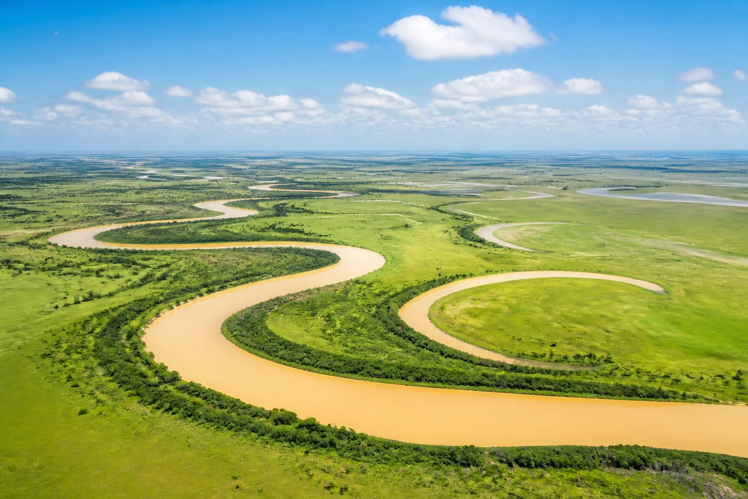
As a meander grows, its looping arms can approach each other. The strip of land between them—the bend’s neck—becomes narrower. If the river cuts across that neck, water takes the new, shorter route and the old loop is left behind. Sediment can seal its ends, creating a curved oxbow lake. Eventually, some oxbows fill with sediment and vegetation.
The process is visible on a grand scale beside South America’s Mamoré River, where numerous abandoned loops border the active channel. The U.S. Geological Survey’s explanation of oxbow lakes along the Mamoré makes the landscape look almost like a record of the river’s former routes. Each crescent marks a place where the water once turned.
Do All Rivers Meander?
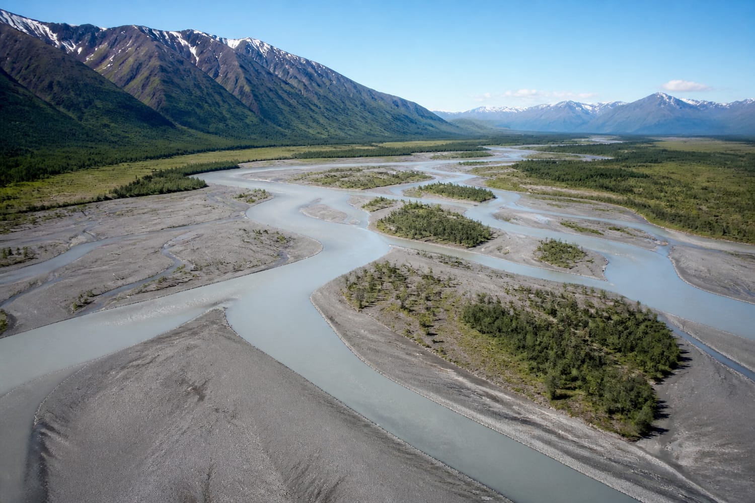
No. Some rivers split and rejoin around bars of sand or gravel, creating a braided pattern instead of one winding channel. Others flow through valleys that constrain how far they can move sideways. River patterns reflect a combination of slope, flow, sediment, and bank conditions—not a neat progression that every river must follow.
Alaska’s Chitina River offers a vivid contrast to a classic meander. Fed by glaciers, it carries abundant sediment and divides into multiple channels around gravel bars. The National Park Service’s description of the braided Chitina River illustrates why “rivers wind” is a useful starting question, but not a description of every waterway.
How Can You Read a River Bend?
At a safe public viewpoint, look for a steep or exposed bank on the outside of a curve. Then look across to the inside: is there a sandy bank or gently sloping bar? Those features may reveal where the river is taking ground away and where it is leaving sediment behind. An aerial view can make the bigger pattern easier to see, especially if nearby crescent-shaped lakes hint at earlier channels.
If your travels take you over a waterway, a bridge can offer another perspective on its shape—though developed riverbanks may not show the same features as an open floodplain. Tour Trivia’s look at iconic bridges across famous rivers offers a few ideas for looking at crossings as more than ways to reach the other side.
The Landscape Never Holds Still
A meander is both a shape and a process. Water rounds a bend, cuts into one bank, and lays sediment along the other; the resulting curve changes the flow that will shape it next. Occasionally, the river takes a shortcut and leaves an oxbow as evidence of where it used to be.
That is the pleasure of knowing the science: a sweeping river view becomes a story you can begin to read. The next time you spot a broad loop, look past its graceful outline. One side is losing ground, the other is gaining it, and the river is quietly drawing its next curve.