
Where Is the Middle, Anyway?
Countries from the United States to Uganda have monuments claiming to mark their geographic centers. Yet “center” can mean the midpoint between extremes, a geometric center of gravity, a survey origin, or the center of the mainland alone. That ambiguity transforms simple markers into fascinating landmarks—and often sparks lively debate.
As the U.S. Geological Survey explains, there is no universally accepted definition or entirely satisfactory method for calculating a geographic center. Islands, irregular borders, territorial changes, and different map projections can all shift the answer.
The result is a wonderfully eccentric category of attraction. Much like the world’s most bizarre landmarks, these monuments turn an abstract idea into something travelers can photograph, climb, circle, or stand beside.
Geographic Center Monument, United States
A small stone monument near Lebanon, Kansas, identifies the geographic center of the contiguous United States. The calculation dates to a 1918 survey and applies only to the 48 adjoining states, excluding Alaska and Hawaii.
The actual calculated point lies on private land, so the roadside monument stands roughly half a mile away. Visitors find a flagpole, a tiny chapel, picnic facilities, and signs welcoming them to “The Geographic Center.” It feels more like a classic Great Plains roadside stop than a grand national monument—which is part of its charm.
A separate marker near Belle Fourche, South Dakota, represents the claimed center of all 50 states.
Lambert Centre, Australia
Deep in the Northern Territory, the Lambert Centre represents the geographic center of mainland Australia. Its centerpiece is a flagpole modeled after the one atop Parliament House in Canberra.
Mathematical modeling was used to calculate the location, although the Royal Geographical Society of Queensland acknowledged that the true point could fall within a few kilometers of the marker. That is still impressive for a continent-sized landmass with an enormously complicated coastline.
Reaching the Lambert Centre is an adventure in itself. The isolated site lies near Finke and is approached by an unsealed track, making road conditions, weather, fuel, and suitable vehicles important considerations.
Centre of New Zealand Monument, New Zealand
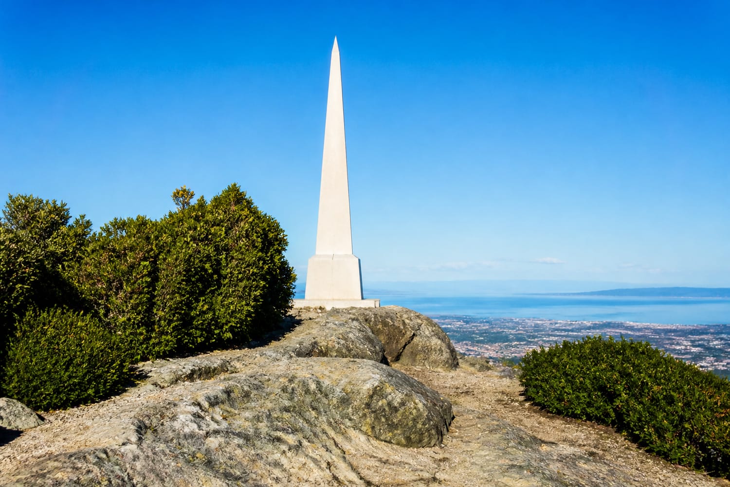
Botanical Hill in Nelson is crowned by a white needle-like monument known as the Centre of New Zealand. A pleasant but steep walk leads to the summit, where visitors are rewarded with views across Nelson, Tasman Bay, and the surrounding hills.
Despite its name, the marker does not represent New Zealand’s modern geographic center. The hill was a central survey point used by chief surveyor John Spence Browning when separate regional surveys were connected during the 1870s.
According to the Nelson City Council’s history of the Centre of New Zealand, a later calculation placed the country’s center in the Spooners Range. The Nelson landmark nevertheless kept its memorable title.
Lake Vivi Monument, Russia
Russia’s claimed geographic center lies beside remote Lake Vivi in the vast Siberian region of Krasnoyarsk Krai. A seven-meter monument was erected there in 1992, shortly after the dissolution of the Soviet Union required the country’s center to be recalculated.
The isolated setting is appropriate for the middle of the world’s largest country. Lake Vivi has no permanent settlements along its shores, and access generally requires a helicopter or a demanding wilderness expedition.
Unlike the accessible roadside marker in Kansas, this is not a casual sightseeing stop. The surrounding territory is protected, and unorganized tourism is restricted, making Russia’s central monument one of the hardest landmarks on this list to reach.
Zero Mile Stone, India
Nagpur’s Zero Mile Stone is closely associated with the idea that the city occupies the center of India. Built during British rule, the sandstone pillar displays distances to several cities and stands alongside four stucco horses.
The monument’s precise original purpose and status as India’s geographic midpoint remain debated. It is more accurately understood as a surveying and distance-measuring landmark connected to the mapping of the subcontinent.
Even so, Nagpur’s central location has helped preserve the popular claim. Unlike many center markers hidden in forests or deserts, Zero Mile Stone stands in a busy urban setting, where colonial surveying history meets modern city life.
Geographic Center of Belgium, Belgium
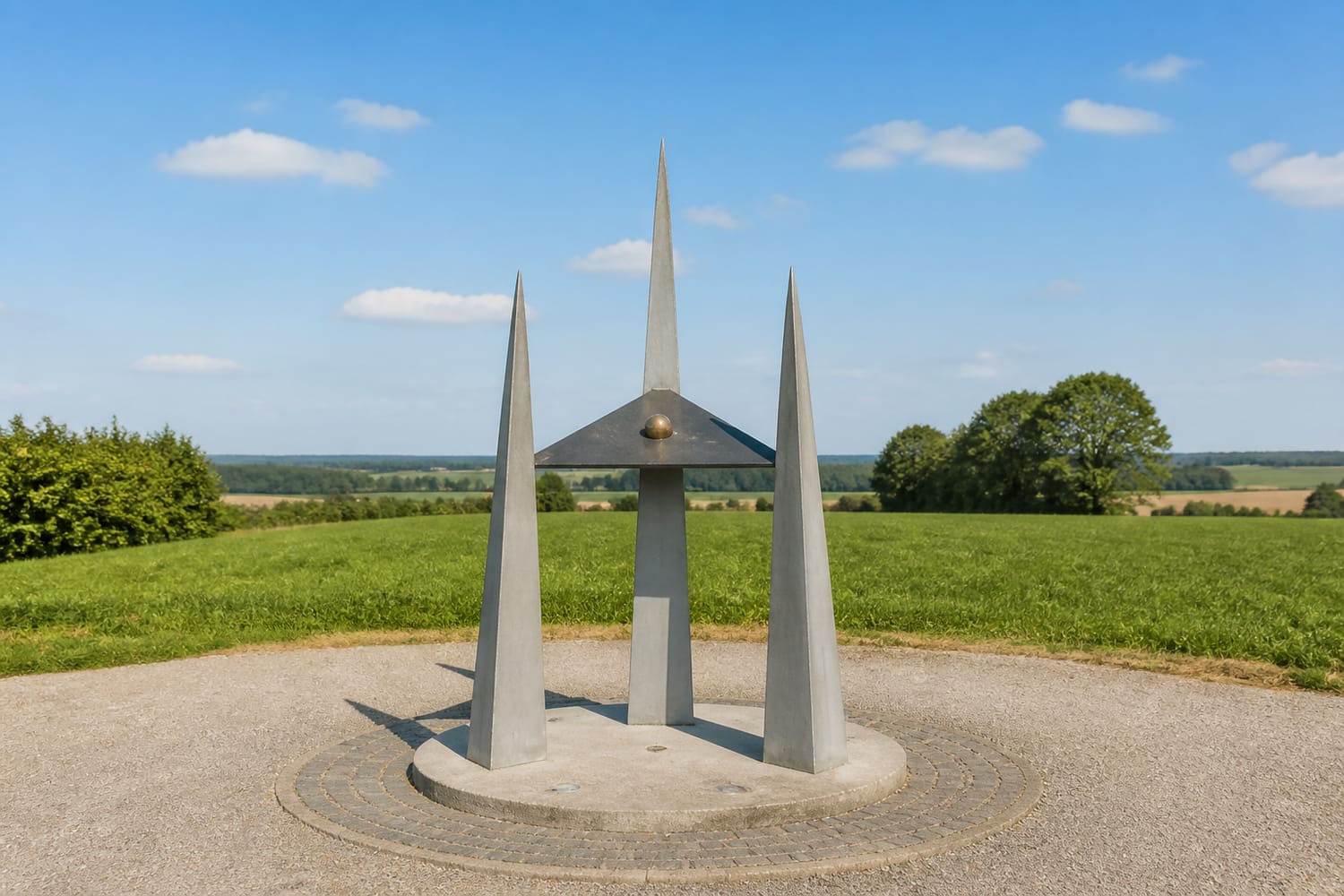
In the rural village of Nil-Saint-Vincent, a small metal monument identifies the geographic center of Belgium. Its design contains several layers of symbolism: three pylons represent the country’s regions, while a triangular element suggests Belgium’s outline.
The point was calculated as the geometric center of gravity of Belgium’s territory. However, even an official center can move. Territorial adjustments along the Belgian-Dutch border in 2018 slightly altered the country’s shape and prompted a recalculation.
The monument is freely accessible and surrounded by peaceful Walloon Brabant countryside—a surprisingly quiet location for the supposed heart of Belgium.
GEOSS Monument, Slovenia
Slovenia gives its center a particularly patriotic treatment. GEOSS, the Geometric Centre of Slovenia, stands near Spodnja Slivna and is marked by an obelisk surrounded by national symbols.
The point represents the geometric center of gravity of Slovenia’s territory. The memorial includes verses from the national anthem, while a traditional linden tree reinforces its connection to Slovenian identity and heritage.
Rather than presenting the site as a purely mathematical curiosity, GEOSS celebrates unity. Cultural events and ceremonies are held nearby, turning an invisible coordinate into a symbolic meeting place for Slovenes.
Picoto da Melriça, Portugal
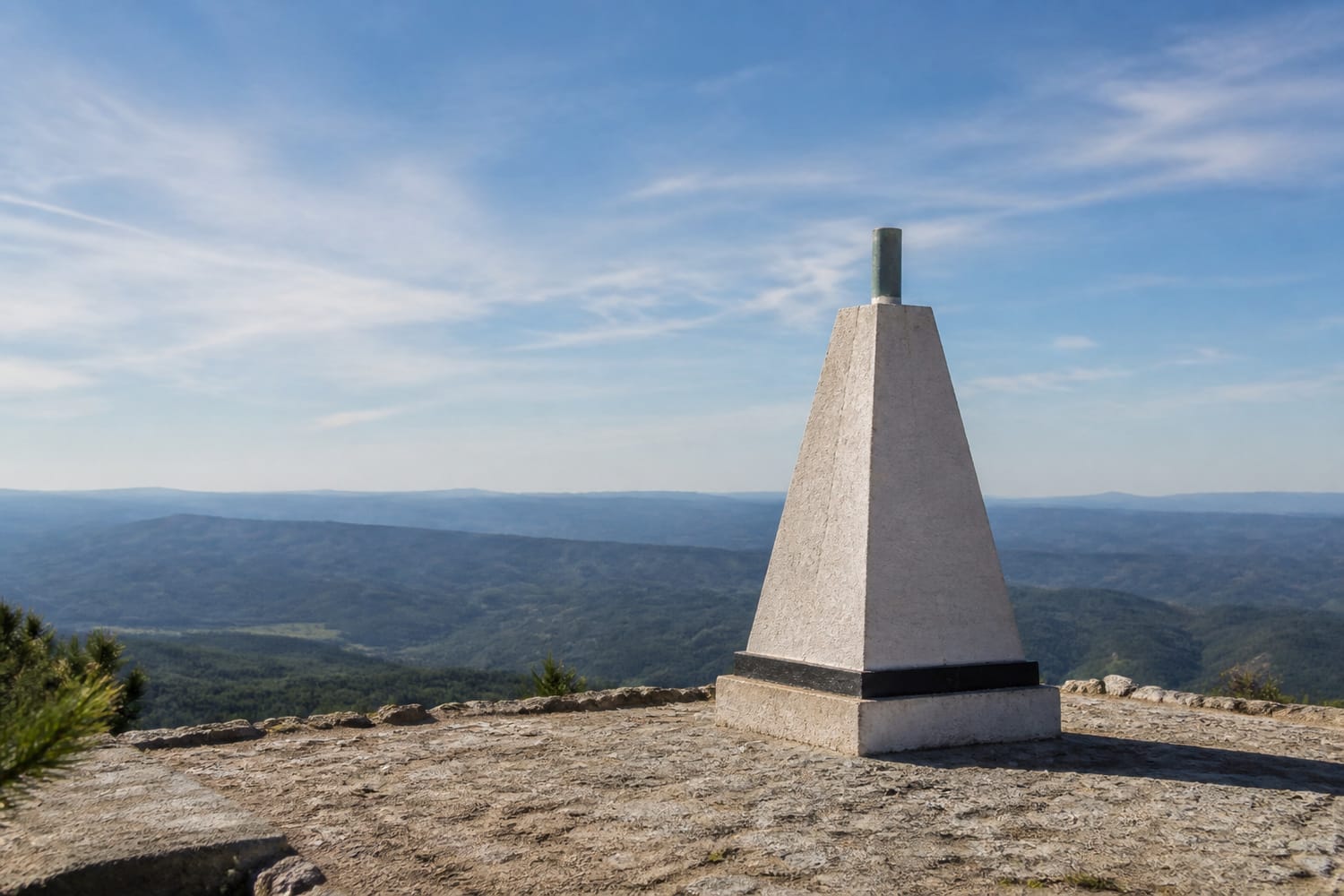
Near Vila de Rei, a masonry surveying pyramid on the Serra da Melriça marks the geodesic center of mainland Portugal. At approximately 600 meters above sea level, the landmark also serves as an impressive panoramic viewpoint.
Visitors can explore the nearby Museum of Geodesy, which explains how surveying and measurement helped cartographers understand the country. On clear days, the surrounding mountains are visible across a broad stretch of central Portugal.
Official tourism information for Vila de Rei and Portugal’s geodesic center describes it using intersecting north-south and east-west lines. Importantly, the calculation concerns mainland Portugal rather than including the Azores and Madeira.
Nihon no Heso, Japan
Nishiwaki calls itself “Nihon no Heso,” or the “Belly Button of Japan.” Its claim is based on the intersection of 35 degrees north latitude and 135 degrees east longitude, coordinates presented as the midpoint of Japan’s geographic extremes.
Nihon Heso Park turns the concept into a full attraction. Visitors can see stone markers and monuments, visit the Terra Dome science museum, and even arrive at Nihon Heso Koen Station on the JR Kakogawa Line.
This is not necessarily Japan’s area-weighted geographic center, particularly given the country’s many islands. Nevertheless, the memorable nickname and coordinate-based calculation have made Nishiwaki’s claim an enduring source of civic pride.
Uganda Tribes Monument, Uganda
The claimed center of Uganda stands in Olyaka village in the Amolatar District, between Lakes Kyoga and Kwania. Known as the Uganda Tribes Monument, it combines geography with a message of national inclusion.
The landmark displays the names of Uganda’s recognized ethnic groups. Surrounding poles symbolize the country’s communities, transforming the central point into an image of different peoples connected around one national heart.
The site remains less developed than many major Ugandan attractions, but local officials and residents have promoted it as a cultural tourism destination. Its combination of geography, identity, and community gives the monument meaning beyond its coordinates.
Why Center Markers Make Great Travel Trivia
These landmarks show that the middle of a country is rarely as straightforward as it appears. Change the calculation, include or exclude islands, adjust a border, or select a different map projection, and the center may move.
Their uncertainty does not make them meaningless. Instead, it gives travelers a reason to ask how nations measure, map, and imagine themselves. Like border landmarks where visitors can stand between countries, center markers make invisible geography feel real—even when another monument somewhere else claims the exact same distinction.