
A Mountain With Its Top Left On
Some mountains rise to a point. Others look as though someone sliced off their summits with a giant knife. Those flat tops usually aren’t the result of a single dramatic event. They are often remnants of once-broader surfaces, left standing as erosion removes the surrounding rock. The shape is a clue to what the mountain is made of—and what used to be around it.
Imagine a layer cake with a firm top and softer layers underneath. Cut away the cake around one portion, and the surviving piece becomes a raised platform. A flat-topped landform can form in much the same way, though rock, water, and gravity do the cutting over immense spans of time.
The Rock Layers That Make a Table
Many tablelands begin with sediment deposited in broad, relatively level layers. Sand may eventually become sandstone; mud may become shale. Later uplift raises those layers, giving streams room to cut down through them. If a resistant layer lies above weaker rock, it can protect the surface beneath it while erosion attacks the edges.
Geologists call that protective layer caprock. The flat top often reflects the position of the rock layer itself: if the layer remains nearly horizontal, the landform it preserves can look remarkably level from a distance. Its sides become steep as weaker material wears away and pieces of the caprock break off. The National Park Service’s guide to plateaus and mesas describes how erosion can divide a broad plateau into isolated, flat-topped remnants.
“Flat,” however, is a matter of perspective. Walk across a tabletop mountain and you may find gullies, shallow slopes, boulders, and vegetation. Its skyline can look straight even when the ground underfoot is anything but smooth.
From Plateau to Mesa to Butte
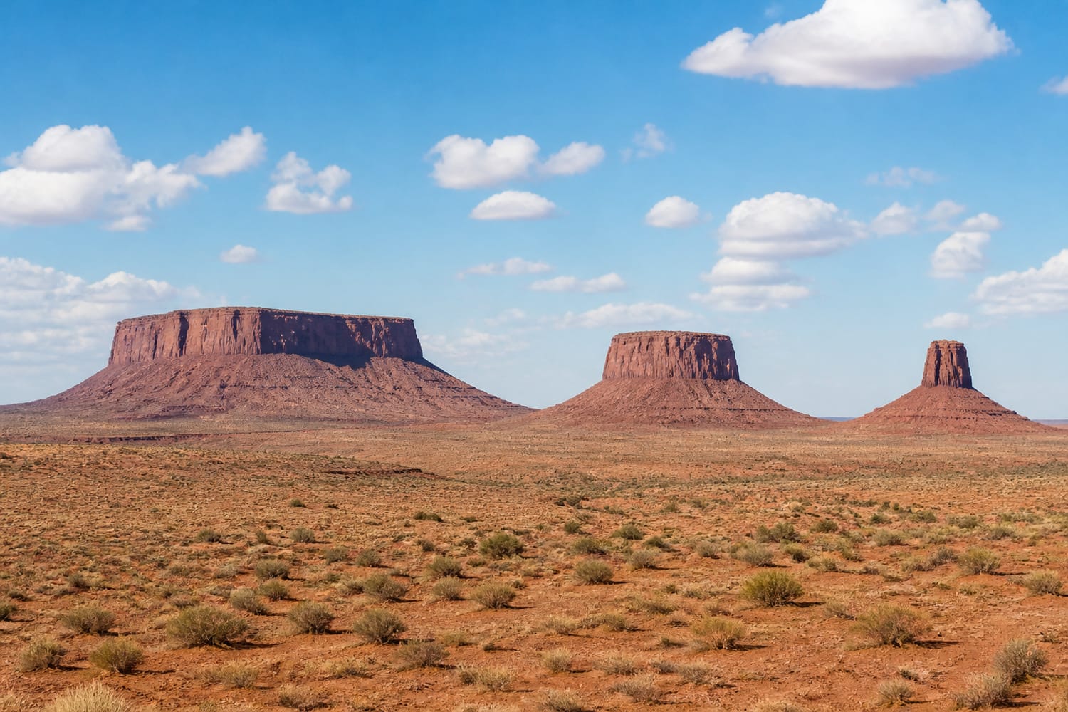
A plateau is a large elevated area with a broadly level surface. As rivers and streams carve valleys into it, portions may become separated from the larger mass. A broad, isolated piece with steep sides is a mesa—a name drawn from the Spanish word for “table.” A smaller remnant is generally called a butte.
These are useful descriptions, not stages every landform must pass through in a tidy sequence. Still, they offer a way to picture erosion at work. Valleys widen; cliffs retreat; a once-continuous surface becomes a collection of high islands. Eventually, even those islands may shrink into narrow pillars. The changing outline resembles the other landscapes in Tour Trivia’s look at places that move and change over time—just on a much longer clock.
Water Does More Cutting Than You Might Think
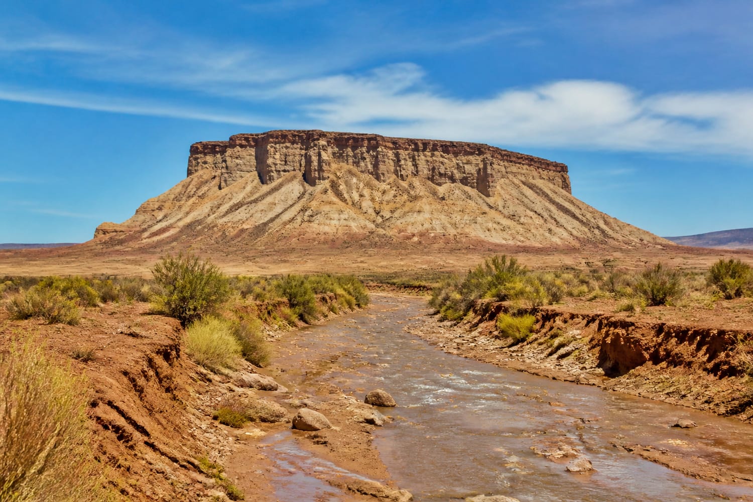
Flat-topped mesas are strongly associated with deserts, so it is tempting to give wind all the credit. Wind can move loose sediment, but running water is a major sculptor, even in dry regions. A brief, intense storm can send water rushing through washes and cracks, carrying loosened rock away.
Weathering starts some of the work by breaking rock apart. Water can seep into fractures, while temperature changes and other processes weaken exposed edges. Gravity finishes many of those jobs: blocks fall from cliffs, exposing fresh surfaces to weathering. Over time, the caprock’s protective edge retreats and the tabletop becomes smaller. The National Park Service notes that water has been the chief erosional agent in shaping Capitol Reef’s desert landscape, with rockfalls also helping shape its cliffs.
That is why a flat top is not a permanent victory over erosion. It is a temporary survivor.
When Lava Becomes the Lid
Not every tableland owes its cap to sandstone. Lava can harden into a resistant layer that slows erosion of the rock beneath it. In one especially surprising version of the story, a lava flow fills an ancient valley. The surrounding, less-resistant land gradually wears down, but the hardened flow remains. What began as low ground can end up standing high.
Geologists call this inverted topography. A landscape has effectively turned its old highs and lows inside out. The National Park Service identifies Johnson Mesa in New Mexico as an example of a lava flow that now holds up a mesa. Volcanic ash deposits can also form resistant caps: at Colorado’s Curecanti National Recreation Area, layers of hardened volcanic material help give mesas their flat tops.
So a tabletop silhouette tells you something important about erosion, but it does not tell you the whole rock story. You need a closer look at the layers—or a geologic map—to know what is holding it up.
Three Tablelands, Three Different Settings
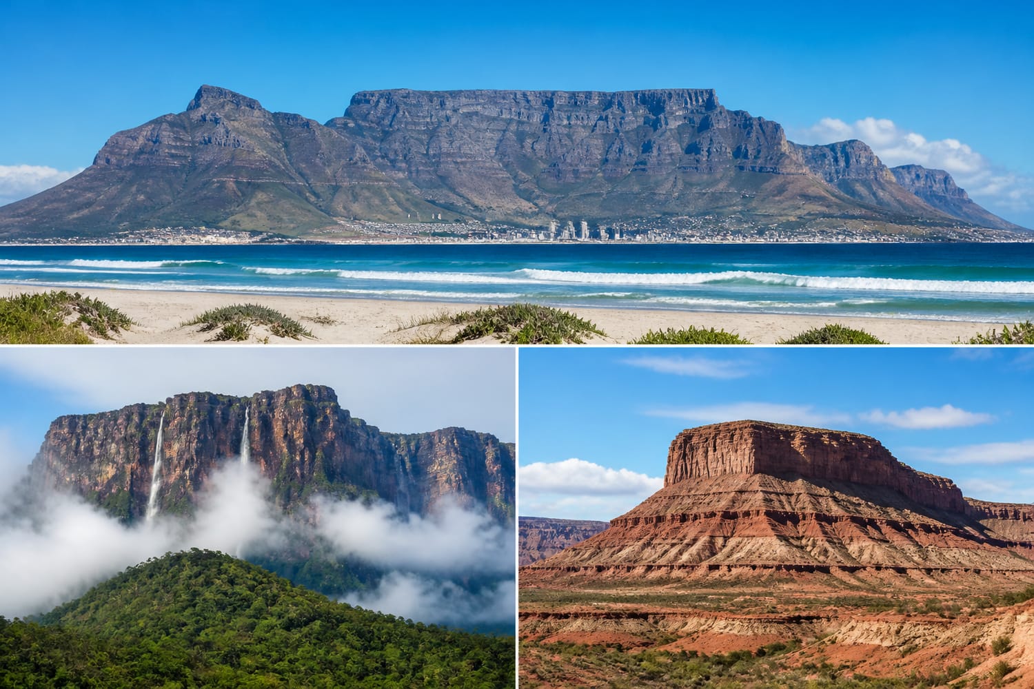
South Africa’s Table Mountain is the image many people summon when they hear “flat-topped mountain.” Its imposing upper slopes are largely sandstone. South African National Parks’ geology guide describes the rock formations that make up the mountain, including the thick sandstone unit responsible for much of its bulk. It is a reminder that a simple outline can hide a complicated history.
In Venezuela’s Canaima National Park, immense table mountains called tepuis rise above the surrounding landscape. UNESCO describes their sheer cliffs and waterfalls, and notes that tepui formations cover much of the park. They show that nature’s tablelands are not confined to the dry American Southwest.
And in the United States, mesa country offers a chance to see broad tops, cliff faces, and smaller buttes in the same view. Each shape helps reveal how much of a former surface may have been removed. For more formations shaped by erosion, Tour Trivia’s guide to natural rock arches and bridges explores another way rock can survive while its surroundings disappear.
How to Read a Flat-Topped Mountain
Next time you spot a tabletop summit, start with its rim. Is there a distinct hard layer along the top? Do softer-looking slopes lie below the cliffs? Can you see other flat-topped hills nearby at roughly the same height? Those are hints that the isolated summits may once have belonged to a broader surface.
Then look for exceptions. A top that tilts noticeably may reflect tilted rock layers rather than a level cap. Mesa Verde, despite its name, is technically a cuesta: the National Park Service explains that its surface dips gently in one direction. Names are memorable, but the rocks have the final say.
Flat-topped mountains are striking because they seem unfinished, as if the Earth paused halfway through making a peak. In a sense, the opposite is true. Their clean-looking summits are pieces of an older landscape that erosion has spent ages taking apart.